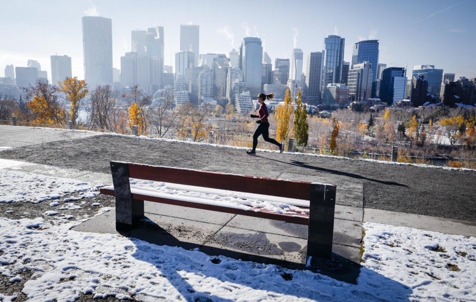
Canada's warmest winter on record is unlikely to make a repeat performance this year, The Weather Network's chief meteorologist says, as a new seasonal forecast suggests the season will try to "salvage its reputation."
Chris Scott says the forecast suggests this winter will be generally colder and more impactful than last year, which saw the warmest winter on record — but it still won't be a "start to finish blockbuster" for any of Canada's regions.
"Winter will at least attempt to salvage its reputation across Canada," he said in an interview this week.
The cold comeback will largely be directed at Western Canada, as the forecast calls for a generally colder season and near- or above-normal snow totals across parts of the West.
But Scott warned those in Ontario and Quebec won't be spared, especially in December.
He suggested the cold that has been locked over Western Canada in recent days, delivering sub-zero temperatures and snow, will soon be unleashed farther east.
"It's coming east in a hurry, and it will pack a real punch," said Scott.
A seasonal forecast is a sketch, Scott said. The picture starts to get "very fuzzy," he said, when forecasters try to predict what will happen more than three weeks out — so it's a little too early to make any white Christmas predictions.
But in Ontario and Quebec, Scott said there could be as much winter weather packed into the next three weeks as there was for a lot of last winter.
"There's going to be a mad scramble for winter tires, mad scramble for salt."
Winter is then broadly expected to back off come January and February in Quebec and Ontario, with the forecast suggesting those provinces will be warmer than normal on the whole, with above average precipitation.
After colder temperatures in the next couple of weeks, Manitoba and Saskatchewan are looking at a more typical winter both in terms of precipitation and temperature, the forecast suggests.
It's generally a good news scenario for drought-weary prairie farmers, Scott said, who rely on snowmelt to help boost soil moisture in the spring.
The iciest conditions are expected farther west, where a colder-than-normal winter in Alberta and British Columbia is expected to be paired with near- or above-normal precipitation across much of the region.
It's good sign for ski resorts across B.C. and into Alberta's foothills — including in Banff and Lake Louise, Scott said.
Scott said he expects the base that has already settled on the mountains will hold until the "snow jets" come back on in January and February. March break skiing in those areas looks "pretty good" too, he said, with the forecast suggesting a late spring could be in the works.
Atlantic Canada should not let its guard down, Scott said, but the forecast suggests one of the stormiest parts of the country may see less activity than it typically does. Storms appear to be tracking more through the Great Lakes region, leaving Atlantic Canada a bit drier and warmer than normal.
The territories are likely to mirror the trends seen further south, Scott said. Yukon and western parts of the Northwest Territories are expected to see below-normal temperatures, while Nunavut is forecasted to be warmer than normal.
It's important to keep in mind that climate change has shifted what is considered normal, Scott said. The forecasts of above- or below-normal temperatures and precipitation are based on average conditions over roughly the past 30 years.
"If we were comparing to a typical winter in the '50s or the '40s, or you go way back into the late 1800s, these winters, the cold we have now, it just doesn't compare," he said.
"It's almost — I wouldn't say impossible — but it's incredibly rare to set all-time record lows now."
Climate change, driven by the burning of fossil fuels, is warming Canada about twice as fast as the rest of the planet, and even faster in the Far North. Average winter temperatures since 1948 have warmed by 3.6 degrees, the latest federal data indicate.
Last year's record warm winter was also driven by El Niño, a natural recurring climate pattern tied to shifting warm water in the 91原创 Ocean and the position of the 91原创 jet stream.
Now, El Niño has faded, and forecasters have been expecting La Niña, its counterpart, to make an appearance, Scott said. During La Niña, trade winds are even stronger than usual and push more warm water toward Asia. Off the coast of the Americas, cold water rises from the depths to the surface.
During a La Niña winter, the Prairies typically get colder while B.C., Ontario and Quebec get more precipitation.
Yet La Niña has "stalled," Scott said.
"La Niña has been afraid to walk through the door, so we're kind of stuck in neutral right now in the 91原创," he said.
"And that's important because the 91原创 Ocean — I like to think of it as the engine that drives the global weather pattern."
How La Niña evolves over the coming months will influence how winter looks in Canada, just one example of how tricky it can be to develop a seasonal forecast, Scott said.
If La Niña "totally stalls," he said, then that would boost the warmer-than-normal conditions in central and eastern Canada. But if La Niña emerges, winter may have "a little bit more fight."
Despite the uncertainty and complexity of making predictions in advance, the "relative forecast versus last winter is very clear," Scott said.
"We've got more winter weather this year, and it's on the way."
This report by The 91原创 Press was first published Nov. 27, 2024.
Jordan Omstead, The 91原创 Press


